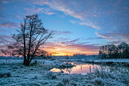
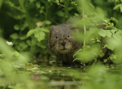
Rivers, lakes and ponds are a vital habitat to many species, whether they live in them, on the bankside or rely on them as a source of food or water.
Rivers act as a corridor through the landscape, connecting up habitats on a vast scale. It’s also important to our welfare that waterways are cared for well to mitigate the effects of floods, drought or pollution, and preserve recreational opportunities and valued natural beauty.
Working on wetlands
Surrey Wildlife Trust’s wetlands team are working on a number of wetland restoration projects and are working toward producing a Wetland Strategy.
Tillingbourne
The Tillingbourne stream supports some of the finest river habitat in Surrey; however much of the channel was modified in past centuries to power a series of mills across the length of the stream.
The channel in many areas is now very straight and overwide and does not support the natural processes required to maintain the habitats that plants, invertebrates and fish need. Surrey Wildlife Trust has been working on a project with the Tillingbourne fly-fishing community to restore natural processes to the river just upstream of Shalford.
Phase 1
Completed in October 2019, Surrey Wildlife Trust staff and volunteers from the fishing club and beyond, installed three berms (low-level shelves created using brushwood and backfilled with woody material) along the channel margins to help create a more natural river course. This allowed marginal plants to take hold and creating cover for fish. Log deflectors were also pinned into the river to re-meander the channel, and bankside trees were coppiced to allow more light to penetrate.
Phase 2
Completed in October 2022 and funded by the Hamamelis Trust. SWT staff and volunteers installed one berm, four twin log deflectors and two brushwood deflectors. Vegetation management also took place, including the coppicing of five bankside trees. A kingfisher nesting burrow was also constructed. This burrow will continue to be monitored, with plans to install a camera trap in Spring 2023.
Cranleigh Waters
Enhancing Ecological Integrity and Flood Resilience: A Case Study of Cranleigh Waters
The Cranleigh area boasts a network of four watercourses—Cobblers Brook, Thornhurst Brook, Cranleigh Waters, and Littlemead Brook—converging into Cranleigh Waters, a vital artery that drains the wider region. Flowing into the South Wey at Shalford before merging with the Thames at Weybridge, Cranleigh Waters plays a pivotal role in the local hydrology. However, the historical dredging of these watercourses have left them with a silty, deep channel, diminishing their ecological value and exacerbating flood risks.
Compounded by the rural character of the area, pollution from various sources poses significant threats to water quality. Over the past five years, the Cranleigh Civic Society has been instrumental in monitoring pollution indicators such as phosphates, providing invaluable data for restoration efforts.
In 2023, a transformative restoration project, funded by Thames Water, The Environment Agency, A2Dominion and Surrey County Council, commenced along a stretch of Cranleigh Waters behind the old plant nursery. Collaborating with Cain Bioengineering, the project aimed to rejuvenate the river ecosystem. The intervention included the installation of brash-filled berms covered in coir matting to promote marginal vegetation and establish a low-flow channel. Additionally, gravel reintroduction, selective tree coppicing to enhance light penetration, and bank regrading to enhance water storage and facilitate natural flood management were implemented.
The immediate post-restoration results were promising, with clearer water and improved low-flow dynamics observed. Ongoing monitoring utilizing camera traps and surveys will track the long-term impact of the intervention. Furthermore, the Cranleigh Civic Society remains actively engaged, assisting in a Himalayan Balsam removal initiative with Surrey wildlife Trust along the restored stretch in spring 2024.
Through collaborative efforts and innovative restoration techniques, Cranleigh Waters is undergoing a revitalization, ensuring both ecological resilience and flood mitigation in the region.
St George's College
Restoring Riverine Habitats: A Comprehensive Approach at St. George's College, Weybridge
Nestled between Addlestone and Weybridge, St. George's College is blessed with the tranquil presence of two vital watercourses, the Addlestone Bourne and the Chertsey Bourne, meandering through its grounds. After their confluence, these waterways navigate through Chertsey Meads before entering the Thames. However, despite their natural charm, these rivers have faced challenges arising from human alterations and environmental factors.
The clay-based catchment surrounding the college, enriched with significant gravel deposits, once shaped the rivers' character. Yet, extensive dredging and straightening, aimed at demarcating boundaries, have depleted the gravel beds, replaced by sediments. Moreover, the proliferation of woodland has cast dense shadows, curtailing the growth of vital marginal plants.
Phase 1
The inaugural phase of the restoration initiative was carried out in 2018 and concentrated on the Chertsey Bourne, recognizing its heightened degradation. Strategic interventions included selective coppicing of trees and instream placement to foster flow diversity and habitat creation. Over 15 tonnes of gravel revitalised the riverbed in places, while brash-filled berms helped to re-meander the river and promote the growth of marginal vegetation. Additionally, a backwater reconnection, enhanced by a reed bed, emerged as a vital sanctuary for pollution mitigation and fish refuge, yielding improvements along the stretch. This was funded by the Environment Agency and St George’s College.
Phase 2
Scheduled for autumn 2024, Phase 2 shifts its focus to the Addlestone Bourne, with ancillary enhancements along the Chertsey Bourne. The removal of a non-native poplar plantation and strategic coppicing initiatives will harness on-site resources effectively. Rejuvenation efforts will encompass the introduction of large woody debris as deflectors to induce meandering, alongside berms and bank regrading to enrich habitat diversity. Gravel supplementation will enhance bed habitat, while strategically placed V-deflectors promise to amplify spawning grounds for fish. Furthermore, the creation of a backwater, repurposed from surface runoff, will establish a sanctuary for aquatic life. This has been funded through a Thames Water enforcement undertaking.

© Jon Hawkins - Surrey Hills Photography
River Condition Assessments
We complete River Condition Assessments for landowners wishing to carry out work that will affect a stretch of river.
A River Condition Assessment (RCA) forms part of a Biodiversity Net Gain Calculation for a river. The Modular River Physical Habitat (MoRPH) survey assesses river habitats and functions and is the tool of choice to attribute a river condition score within the Defra Biodiversity Metric.
If you would like to enquire about getting a River Condition Assessment completed, please email nbs@surreywt.org.uk.
Nature Based Solutions
Surrey Wildlife Trust use Nature Based Solutions in our Wetlands Work and elsewhere. Find out more about what Nature-based Solutions are and how we’re using them.
Working in partnership
We also work with a wide range of other organisations who have an interest in our wetlands, primarily through our role co-hosting the River Mole Catchment Partnership and Wey Landscape Partnership with the South East Rivers Trust. You can find out more about these partnerships by taking a look at our Storymaps:
River Mole Catchment Partnership
FAQs
Contact us
If you have another wetland-related query, please email catchmentpartnerships@surreywt.org.uk.

